Spooner Summit to Kingsbury North

Distance: 12.2 miles
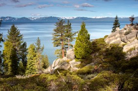
Highlights: Panoramic Views of Lake Tahoe, Ancient Firs
Trailheads
Spooner Summit South: On S side of Hwy 50 just west of summit. Trailer parking available. Vault toilets, picnic tables.
Kingsbury North: From Hwy 207 just W of summit turn N onto N. Benjamin Dr. (which becomes Andria Dr.) and drive 2 mi. to dead end. Limited roadside parking with no facilities
Kingsbury South: 1.5 miles south of Hwy 207 on Tramway Drive at base of Stagecoach chairlift. Trailer parking available. No facilities.
Trail Info
Signage: The trail is marked at intervals with light blue, triangular TRT logo signs.
Best Season: Early June to mid October
Distances
Spooner to Sierra Canyon Trail 6.7 mi
Spooner to Kingsbury N TH 12.2 mi.
Spooner to Kingsbury Loop Junct 14.4 mi.
Spooner to Van Sickle Connector 17.3 mi.
Elevation
Spooner Summit: 7150′
South Camp Peak: 8866′
Kingsbury North: 7780′
Water Sources
This entire section of the TRT is dry, so be sure to carry extra water. All water found on the trail must be treated before drinking.
Multiple Use Trail
The TRT hosts bikers, equestrians and hikers. Please yield accordingly
Camping: Camping is allowed within 300’ of the trail and 200’ away from a water source.
Fire: USFS permit required for camp stove as fire regulations allow. Fire danger can be extreme and fires, camp stoves and smoking may be prohibited. Check trailhead kiosks or call the USFS (530-543- 2600) for current regulations.
Terrain: Easy to moderate climb on smooth and sandy trails from Spooner to South Camp. South Camp Peak to Kingsbury is more technical due to rocky steps and terrain.
Mt. Bikers & Equestrians: Mt. bikers, horseback riding and stock allowed on entire section. Be aware of other trail users.
Leave-No-Trace: The TRTA supports and encourages LNT practices while on the trail.
1. Plan Ahead and Prepare
2. Travel and Camp on Durable Surfaces
3. Dispose of Waste Properly
4. Leave What You Find
5. Minimize Campfire Impacts
6. Respect Wildlife
7. Be Considerate of Other Visitors
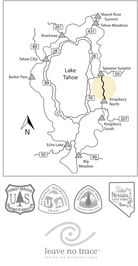
Caution – Be prepared for sudden weather changes and be sure to carry a complete TRT or Tahoe Basin map. The map on reverse side is limited.
Lake Tahoe Hiking
Lake Tahoe hiking – embark on an adventure into unspoiled wilderness! Lake Tahoe hikes are an excellent way to experience the natural beauty of the region. Fill your lungs with pure mountain air, burn some energy on a challenging slope, and then pause to rest at the summit and take in the gorgeous views. Discover many more trails by region: North Lake Tahoe Hiking Trails and South Lake Tahoe Hiking Trails – your gateway to amazing natural wonders.
Information Provided by
Tahoe Rim Trail Association
PO Box 3267
128 Market Street, Suite 3E
Stateline, NV 89449
(775) 298-0012
info@tahoerimtrail.org
www.tahoerimtrail.org


